Error message

  • Lingotek profile ID 4 not found.
  • Lingotek profile ID 3 not found.
California's New Desert Monuments
Sierralara/Alamy

California’s New Desert Monuments

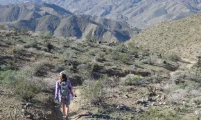
You could call it a monumental achievement: In February 2016, three new national monuments were created, protecting a combined total of 1.8 million acres of California desert. The names of the preserves evoke the scenery they protect: Sand to SnowMojave Trails, and Castle Mountains.

“This designation protects a heroic, beautiful landscape for solitude, inspiration, and outdoor recreation,” says David Myers, executive director of the Wildlands Conservancy, a group that has worked tirelessly with California’s U.S. Senator Dianne Feinstein to give the lands federal protection. “The monuments link the landscapes of eastern California from the San Bernardino Mountains through Joshua Tree National Park and all the way up toward Death Valley,” explains Myers. Though some of this acreage was already protected within desert preserves or wilderness areas, these new national monuments bind together smaller parcels—and their delicate ecosystems—under one big safety net.

Now desert dwellers like bighorn sheep, golden eagles, fringe-toed lizards, and desert tortoises have nearly 2 million protected acres to call home.

“The national monuments provide a critical habitat linkage for many rare and endangered species,” Myers says. Now desert dwellers like bighorn sheep, golden eagles, fringe-toed lizards, and desert tortoises have nearly 2 million protected acres to call home.

It may be several years before more trailheads and visitor centres are built, but there are still plenty of ways and places to explore these unique and beautiful lands. Just go prepared. Take plenty of water and snacks, layer on the sunscreen, wear a hat, and bring extra layers of clothes. (Deserts can be surprisingly cold once the sun goes down.) Consider renting a high-clearance 4WD vehicle for navigating rough, unpaved roads, and gas up before you head in. Plan your route in advance and share details with friends or family at home; cell service is spotty or non-existent in these preserves. 

—Ann Marie Brown

Sand to Snow National Monument
Ann Marie Brown

Sand to Snow National Monument

Sand to Snow National Monument
Explore a wild paradise for bird lovers and adventurous hikers

Called “the most botanically diverse national monument in America,” by David Myers, the preserve gets its name from dramatic changes in elevation, which range from the sandy desert floor to Mount San Gorgonio’s 11,502-foot summit, the highest peak in Southern California and often capped with snow well into spring.

To visit the sandy part of Sand to Snow, head to the Whitewater Canyon Preserve area within the monument—the turnoff for Whitewater Canyon is five miles west of Palm Springs on Interstate 10. Take Whitewater Canyon Road five miles north to the trailhead, then follow Whitewater River’s usually dry wash for two miles to reach Red Dome, a rust-coloured hill caused by what could be called a volcanic burp that welled up to the earth’s crust. Or, for a heart-pumping ascent, follow the 3.5-mile Canyon View Loop Trail. You’ll climb nearly 1,000 feet for big views of the surrounding peaks. The loop follows a section of the Pacific Crest Trail on its epic journey from Mexico to Canada.

If you prefer your paths lush and leafy, stop in at Big Morongo Canyon Preserve, a wild oasis for bird lovers. Song sparrows flit and hummingbirds whiz by as you follow the Mesquite Trail’s boardwalks through a marshy maze of willows and cottonwoods. Nearly 250 avian species have been spotted at this jungle-like wetland surrounding Big Morongo Creek.

To visit the snowy parts of Sand to Snow, Myers recommends a local favourite: a trip to the hamlet of Forest Falls and a short hike on the Vivian Creek Trail—via snowshoes in winter or hiking boots in summer. To reach the trailhead, continue west on I-10; take the exit to Yucaipa and follow State Highway 38 north, then east to Forest Falls. The trail also leads to an 8.5-mile ascent up to San Gorgonio’s summit, but be warned: It’s an epic quad burner with more elevation gain than the ascent up Yosemite’s Half Dome. Plan on at least 12 hours round trip, and take plenty of food and water. When you're done, reward your effort with a new pair of hiking boots from the Ecco outlet at Desert Hills Premium Outlets, home to dozens of high-end outlets. Head 11 miles west on I-10 to Cabazon and the outlets.


Mojave Trails National Monument
Ann Marie Brown

Mojave Trails National Monument

Mojave Trails National Monument
Follow the Mother Road to volcanoes, sand dunes, and breathtaking vistas

Protecting a staggering 1.6 million acres, this dramatic desert monument west of Needles lets you discover towering sand dunes, magical mountain ranges, and remnants of a volcanic past. Mojave Trails National Monument contains “some really grand national treasures,” says David Myers, executive director of the Wildlands Conservancy, including what he calls as “the longest undeveloped stretch of historic Route 66.”

Get your kicks on a three-mile round-trip hike to Amboy Crater, a 250-foot-high cinder cone that is one of North America’s youngest volcanoes. Afterwards, snap a few selfies in Amboy, the self-proclaimed “ghost town that ain’t dead yet.” Almost entirely abandoned, the town, which features the remnants of a school, a church, a garage, a cemetery and even an airport, is famous for embodying the desolate loneliness of a desert community that was thriving in the 50s and 60s but has since been left behind. If Roy’s Cafe is open, stock up on road-trip snacks and Route 66 trucker hats.

Mojave Trails also contains the dramatic Bigelow Cholla Garden Wilderness. The preserve, 18 miles west of Needles, protects California’s densest population of the fluffy looking, knee-high cactus—the Bigelow cholla—that’s a photographer’s dream when backlit by late afternoon light. (Don’t touch—cholla spines can be extremely difficult to remove.) At dusk and dawn, keep your eyes peeled for jackrabbits and coyotes. Stargazers and geology enthusiasts should head to Afton Canyon, a rainbow-hued gorge carved out by a Pleistocene-era flood. Sometimes called “the Grand Canyon of the Mojave,”the area is a designated watchable wildlife area, home to bighorn sheep, roadrunners, and various kinds of raptors that nest in the canyon walls.


Castle Mountains National Monument in California's Deserts Region
Gina Ferazzi/Getty Images

Castle Mountains National Monument

Castle Mountains National Monument
See spectacular spires and surprising desert “forests”

The most northerly of the desert region's three new national monuments designated in 2016, Castle Mountains National Monument is wrapped on three sides by Mojave National Preserve. At just shy of 21,000 acres, it’s the smallest of the three monuments. But smaller doesn’t mean less noteworthy. The focal point is Castle Peaks, a cluster of epic spires that soar skyward like the ramparts of an ancient fortress. At the mountains’ feet lie some of the Mojave Desert’s best grasslands, plus sweeping dense forests of twisted junipers and Joshua trees, a type of yucca that looks like it jumped straight out of a Dr. Seuss story.

The area is a treasure trove of human history too. Native American archaeological sites have been discovered here, and the historic gold-mining town of Hart hints of the challenges of living in the desert’s harsh conditions. These and other finds offer a fascinating glimpse into this surprisingly diverse and beautiful preserve.