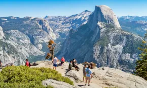
With more than 800 miles of trails leading to lofty summits, roaring waterfalls, sparkling lakes, and serene meadows, Yosemite National Park is a hiker’s paradise.
Some of the park’s most beloved hikes are found in world-famous Yosemite Valley, a geologic marvel carved by glaciers and bracketed by soaring cliffs and spires. Every trail here offers huge rewards for your time and effort, but don’t limit your trekking—Yosemite Valley covers only about 1 percent of the park. You’ll find more natural wonders to explore in the high country of Tuolumne Meadows and Tioga Pass, near Glacier Point, and in the park’s southern reaches.
The trails below include quintessential Yosemite hikes like Half Dome and Yosemite Falls, plus lesser-known treks to grand viewpoints, turquoise lakes, glistening cascades, and wildflower-filled meadows.
MORE: FAQ: What to Know About Visiting Yosemite National Park
Hiking Trails in Yosemite for Beginners
Lower Yosemite Fall: Yosemite Valley
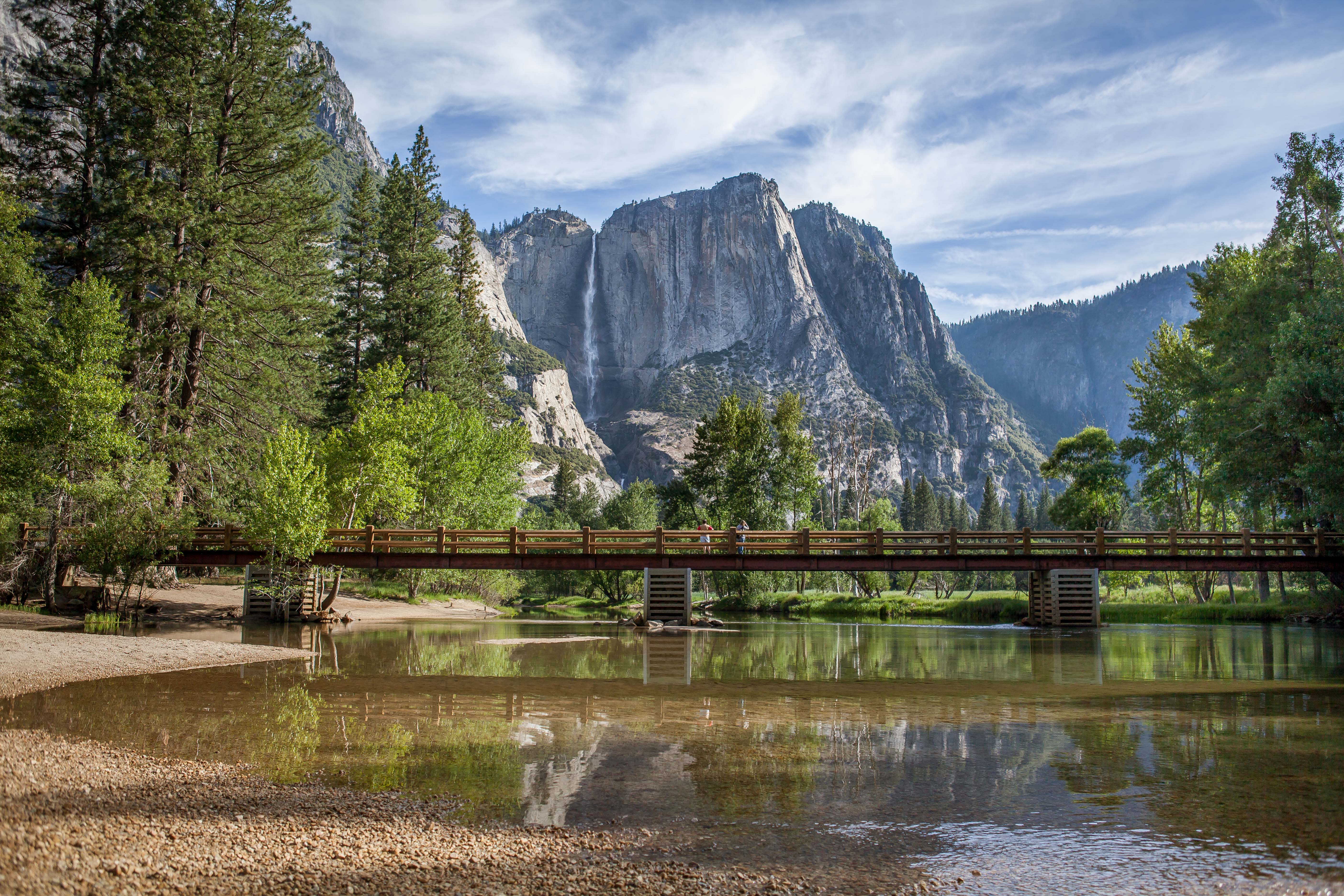
In spring or early summer, Lower Yosemite Fall is a must on every Yosemite hiker’s list. A gentle, wheelchair-accessible path leads to an overlook near the base of its whitewater plume, which gushes with snowmelt from March to June. This is the lowest of Yosemite Falls’ three tiers; together they make up North America’s tallest free-leaping waterfall with a height of 2,425 feet. By midsummer, Yosemite Fall often dries up completely, but this easy loop among towering pines and firs makes a pleasant walk any time.
Distance: 1-mile loop
Difficulty: Easy
Trailhead: Lower Yosemite Fall
Getting there: Park in the official lots at Yosemite Falls parking/Lodge area and make the 15-minute walk to the trail head, or take the shuttle to stop #6 near Yosemite Valley Lodge
More info: Lower Yosemite Fall Trail
Bridalveil Fall: Yosemite Valley
An easy out-and-back walk leads to a viewing platform with a close-up look at Yosemite Valley’s most dependable waterfall, Bridalveil Fall. The 620-foot-high cataract flows year-round thanks to Bridalveil Creek’s heavily forested drainage, which soaks up snowmelt like a sponge, then releases it slowly. Bridalveil is most enthusiastic in spring, when you can hear ice chunks plunge over its lip with a furious crack.
Distance: 0.5-mile round trip
Difficulty: Easy
Trailhead: Bridalveil Fall
Getting there: On Wawona Road/Highway 41 near the Southside Drive junction, park at the Bridalveil Fall parking area off Southside Drive
More info: Bridalveil Fall Trail
 Stefan Cristian Cioata / Getty Images
Sentinel Dome and Taft Point: Glacier Point Road
On Glacier Point Road, two beginner-friendly trails begin at the same trailhead. The 2-mile hike to Sentinel Dome will make you feel like a bona fide mountaineer after conquering the climb to the dome’s rounded summit. The 360-degree panorama includes a breathtaking perspective on Yosemite Valley and dozens of High Sierra peaks.
The 2.2-mile Taft Point Trail offers completely different vistas—a full-frontal view of El Capitan’s vertical face and a dizzying glimpse 3,500 feet down to Yosemite Valley’s floor. (Hold tight to the railing as you peer over Taft Point’s sheer cliff.)
Distance: 2.0 miles round trip for Sentinel Dome; 2.2 miles round trip for Taft Point
Difficulty: Easy to moderate
Trailhead: Sentinel Dome/Taft Point
Getting there: On Glacier Point Road, 2.5 miles west of Glacier Point, there is a small parking lot at the trailhead
More info: Sentinel Dome and Taft Point
Mariposa Grove of Sequoias: Wawona
Near the park’s South Entrance, the Mariposa Grove of Giant Sequoias offers easy walking among some of the world’s largest trees by volume, including hundreds with diameters topping 10 feet. Most visitors stick to the lower grove, home to famous sequoias including the massive Grizzly Giant—209 feet tall and 30 feet in diameter at its base—but if you don’t mind some climbing, the upper grove is also worth a look.
Distance: 2.2 miles round trip for lower grove; 6.8 miles for upper and lower groves
Difficulty: Easy to moderate
Trailhead: Mariposa Grove
Getting there: On Highway 41/Wawona Road, 0.2 mile north of Yosemite’s South Entrance. From mid-April to November, you must ride a shuttle bus from the Mariposa Grove Welcome Plaza to the grove entrance. In winter and early spring, you can walk the 2-mile Washburn Trail to the grove (or shuffle in on snowshoes).
More info: Mariposa Grove of Giant Sequoias
Tuolumne Grove: Crane Flat
On the park’s northwest side, take a ramble around the impressive sequoias of the Tuolumne Grove. The trail follows the former Big Oak Flat Road downhill through a shady forest of sugar pines, white firs, and dogwoods. In about one mile, you reach the first of the grove’s 25 mature sequoias, and it’s a doozy. Nearby is the Dead Giant, a 20-foot-tall sequoia stump that was tunneled in 1878 so that wagons, and later automobiles, could drive through. Today everybody walks through it for the perfect souvenir selfie.
MORE: Guided Tours of Yosemite
Distance: 2.5 miles round trip
Difficulty: Easy to moderate
Trailhead: Tuolumne Grove
Getting there: 0.7 mile north of Crane Flat gas station on Hwy. 120, look for the Tuolumne Grove trailhead parking lot
More info: Tuolumne Grove
Soda Springs: Tuolumne Meadows on Tioga Pass Road
For an easy subalpine stroll, head to the daydreamy paths that crisscross Tuolumne Meadows, one of the Sierra’s largest high-elevation meadows. From the Parsons Lodge parking lot, you’ll cross Tioga Pass Road and meander along a wide, level path, passing grazing mule deer and placid pools in the Tuolumne River. After crossing a wide footbridge, you’ll spot the log structure at Soda Springs. Here, iron-rich carbonated water percolates up from a deep spring, tinting the ground orange. At sunset, you can watch the granite peaks glow orange, too.
Distance: 1.4 miles round trip
Difficulty: Easy
Trailhead: Parsons Lodge parking lot
Getting there: At Tuolumne Meadows, 8 miles west of Yosemite’s Tioga Pass entrance, park near the Tuolumne Meadows Visitor Center
More info: Soda Springs and Parsons Memorial Lodge
Hiking Trails in Yosemite for Advanced Hikers
Half Dome: Yosemite Valley
Hikers willing to tackle serious elevation gain earn a bonanza of eye-candy on Yosemite’s high summits. The most famous is Half Dome, a rounded granite dome that looks like it was sheared in half.
To earn a spot on this bucket-list summit, you face a 16-mile grind and prodigious 4,800-foot ascent. The trail passes Vernal and Nevada Falls and dozens of thrilling granite vistas, but the biggest drama occurs just below Half Dome’s summit, where you must use both arms and legs to pull yourself up a 400-foot-long stretch of steel cables anchored into nearly vertical rock. Reserve a permit in the lottery system far in advance for this popular trail.
Distance: 16.0 miles round trip
Difficulty: Strenuous
Trailhead: Happy Isles, 0.7 mile east of Curry Village
Getting there: Park in Curry Village or at the Yosemite Valley Trailhead Parking Lot and walk in (depending on your start time) or take the Shuttle to stop #16
More info: Half Dome Day Hike
Clouds Rest: Tioga Pass Road
Clouds Rest is another granite monolith that earns hikers bragging rights. With a summit elevation of 9,926 feet—1,000 feet higher than Half Dome—this dramatic ridgeline of glacier-carved rock boasts one of the best views of Tenaya Canyon and Yosemite Valley, plus Mount Conness, Mount Lyell, Mount Watkins, and countless more famous landmarks. From the Sunrise Lakes Trailhead, the trail starts out gently enough, but the demanding grade between miles 1.5 and 2.5 will put your fitness to the test. Don’t give up—the path mellows out in the next stretch, and the summit view will knock your socks off.
Distance: 14.0 miles round trip
Difficulty: Strenuous
Trailhead: Sunrise Lakes
Getting there: On Tioga Pass Road at Tenaya Lake’s western edge, the Sunrise Lakes Trailhead parking lot off Tioga Road serves as parking
More info: Sunrise Lakes/Clouds Rest
Mount Dana: Tioga Pass Road
Yosemite’s second-highest summit, Mount Dana, towers over Tioga Pass at a height of 13,061 feet. Dana’s summit trail is only 3 miles one-way, but it comes with a gain of 3,100 feet. If you can muscle your way up that grade, you’re rewarded with one of the Sierra’s finest vistas, encompassing Mono Lake, Glacier Canyon, Tuolumne Meadows, and an untold wealth of peaks and precipices.
Want more? In late July, this trail comes with a bounty of high-alpine wildflowers, including clusters of blue sky pilot that dot the rocky summit.
Distance: 6.0 miles round-trip
Difficulty: Strenuous
Trailhead: Tioga Pass Entrance Station
Getting there: On Tioga Pass Road, 13 miles west of Lee Vining, Gaylor Lakes Lot can be used for parking
More Info: Mount Dana
Best Waterfall Hikes at Yosemite
Bridalveil, Lower, and Upper Yosemite Falls: Yosemite Valley
For waterfall fans visiting Yosemite Valley during spring and early summer, Bridalveil Fall and Lower Yosemite Falls are musts (see Hiking Trails in Yosemite for Beginners, above).
But if your quadriceps are in tip-top shape, don’t stop with these easy waterfall trails—take on the challenge of 100 switchbacks and 2,900 feet of ascent to the brink of Yosemite Falls’ upper cascade. April and May are the best months for peak flow.
Distance: 7.2 miles round trip
Difficulty: Strenuous
Trailhead: Camp 4
Getting there: Shuttle stop #7 or park in designated lot at Yosemite Valley Lodge, there is official parking at the trailhead
More info: Yosemite Falls Trail
Vernal and Nevada Falls: Yosemite Valley
Another not-to-be-missed waterfall hike is the famous Mist Trail to Vernal and Nevada Falls, two Merced River cataracts that roar with snowmelt in spring. During peak runoff, carry a rain poncho in your day-pack or risk getting soaked from the falls’ misty spray. From Happy Isles, a 5.4-mile hike leads you up (and back down) the Mist Trail’s granite staircase, with stops at the brink of both waterfalls. If you tucker out, turn back at the top of Vernal Fall for an easier trek.
Distance: 2.4 miles round trip for Vernal Fall; 5.4 miles round trip for Nevada Fall
Difficulty: Moderate to strenuous
Trailhead: Happy Isles, 0.7 mile east of Curry Village, parking is available at Happy Isles and Curry Village
Getting there: Shuttle stop #16
More info: Vernal Fall and Nevada Fall Trails
Chilnualna Falls: Wawona
A challenging climb leads you to the brink of Chilnualna Falls’ five-tiered cascade, best seen from March to May during peak runoff.
This trail gains a hefty 2,400 feet, but you’ll be spurred onward by the intoxicating aroma of bear clover and the good company of California black oaks. Halfway up, pause to stretch your hamstrings at a granite overlook with a broad view of Wawona Dome. Shortly beyond, you’ll catch a distant glimpse of the waterfall dropping over a granite cliff. Keep trekking until you reach the lip of the uppermost cascade, the pinnacle of five showering whitewater drops.
Distance: 8.2 miles round-trip
Difficulty: Moderate to strenuous
Trailhead: Chilnualna Falls
Getting there: On Chilnualna Falls Road, 1.7 miles east of Wawona, official parking at the trailhead
More info: Chilnualna Falls Trailhead
Great Hidden-Gem Hikes at Yosemite
Dewey Point: Glacier Point Road
Some Yosemite trails are short on crowds but don’t skimp on scenery, like this hike to Dewey Point. Start from the McGurk Meadow Trailhead with a walk through a shady lodgepole pine forest, which soon opens up to a wildflower-dotted meadow (look for an old sheepherder’s cabin here). Connect to Pohono Trail and head west to Dewey Point, a rocky promontory on Yosemite Valley’s south rim with an awe-inspiring view of El Capitan, Half Dome, Cathedral Rocks, and much more.
Distance: 7.8 miles round trip
Difficulty: Moderate
Trailhead: McGurk Meadow
Getting there: On Glacier Point Road, 8 miles east of Chinquapin junction, official parking at trailhead
More info: McGurk Meadow Trailhead/Dewey Point
Lukens Lake: Tioga Pass Road
In early summer, you’ll find a bounty of early-summer wildflowers at Lukens Lake, including thousands of delicate purple shooting stars. Even if you miss the bloom, you’ll be rewarded with serenity on this woodsy trail that travels from White Wolf Campground to the warm, spring-fed lake. On summer days, wade into the water and watch the dragonflies and damselflies flitting across the lake surface.
Distance: 4.6 miles round trip
Difficulty: Easy
Trailhead: White Wolf Campground
Getting there: On Tioga Pass Road, 15 miles east of Crane Flat, designated parking at the trailhead
More info: Lukens Lake Trailhead from White Wolf
Pothole Dome: Tuolumne Meadows on Tioga Pass Road
Pothole is not Yosemite’s largest granite dome, but it’s uniquely positioned on the end of Tuolumne Meadows, and its summit delivers lofty vistas with only a short hike and easy ascent up grippy granite. You’ll reach the top in no time at all, and after enjoying the expansive view from every angle, head back down and take a detour: A well-trod path leads from the dome’s north side to a series of deep pools and cascades on the Tuolumne River.
Distance: 1-2 miles round trip
Difficulty: Easy
Trailhead: Pothole Dome
Getting there: West end of Tuolumne Meadows, 10 miles west of Yosemite’s Tioga Pass entrance, designated parking is off Tioga Pass to the West of the meadow
More info: Pothole Dome Trailhead
Wawona Meadow Loop: Wawona
This less-traveled path is ideal for park visitors traveling with their dogs. Although pets aren’t permitted on the vast majority of Yosemite trails, your canine is welcome here and will love this easy romp around one of the park’s largest meadows. Located adjacent to Wawona Golf Course, Wawona Meadow is home to a wide variety of wildflowers from late April to late June, including goldfields, star tulips, yarrow, and Sierra onions.
Distance: 3.5-mile loop
Difficulty: Easy
Trailhead: Wawona Golf Course
Getting there: On Highway 41 across from the Wawona Hotel, park at the Wawona Hotel lot
More info: Wawona Meadow