The turreted summit of 9,103-foot Castle Peak is a worthwhile destination for any crystal-clear day, when the panorama extends more than 100 miles north to Lassen Peak and west to the Diablo Range. But according to botanist Karen Wiese, the region’s diverse landscape—including “the lush meadow of Castle Valley, the dry slopes of Castle Peak, and the towering volcanic summit”—yields seriously awesome flowers by mid-July.
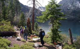
From I-80 just east of Soda Springs, the route follows the Pacific Crest Trail northwest through Castle Valley, which Wiese describes as “a delightful subalpine meadow with Lewis’s monkeyflower, little elephant’s head, alpine shooting star, corn lily, and monkshood.” Watch for an early-summer flower prize: the unusual steer’s head, a tiny pale pink flower whose petals resemble a steer’s horns and snout.
The ascent is moderate to Castle Pass, but the final mile to the summit will test your stamina. Use the flowers as your excuse—stop to catch your breath to admire carpets of pink star onion, spreading phlox, and sulfur buckwheat. Wiese’s summit tip: “Look just below the summit on the north side and you may discover Sierra primrose and rock fringe (both colored a showy magenta pink).”
All told, the route is about 10 miles round trip. (There is a popular dirt road that cuts off almost four miles, but you’ll miss lots of flowers.)
DIRECTIONS TO TRAILHEAD: Take the Castle Peak/Boreal Ridge exit off I-80 at Donner Summit. The Pacific Crest Trail begins on the south side of I-80; the dirt road shortcut begins on the north side, at the end of the frontage road.