
For the latest on COVID-19 (Coronavirus) click here

photo by paraflyer/Flickr
Volcanoes, Geysers, & Hot Springs
From the snow-capped heights of Mount Shasta in California’s far north to Amboy Crater in the Mojave Desert, signs of California’s volcanic past—and present—dot the landscape. Explore these remarkable geological features and how they helped shape the state--descend into a lava tube, climb to a crater rim, watch a geyser spout, or soak in a naturally heated spring.
Kodiak Greenwood
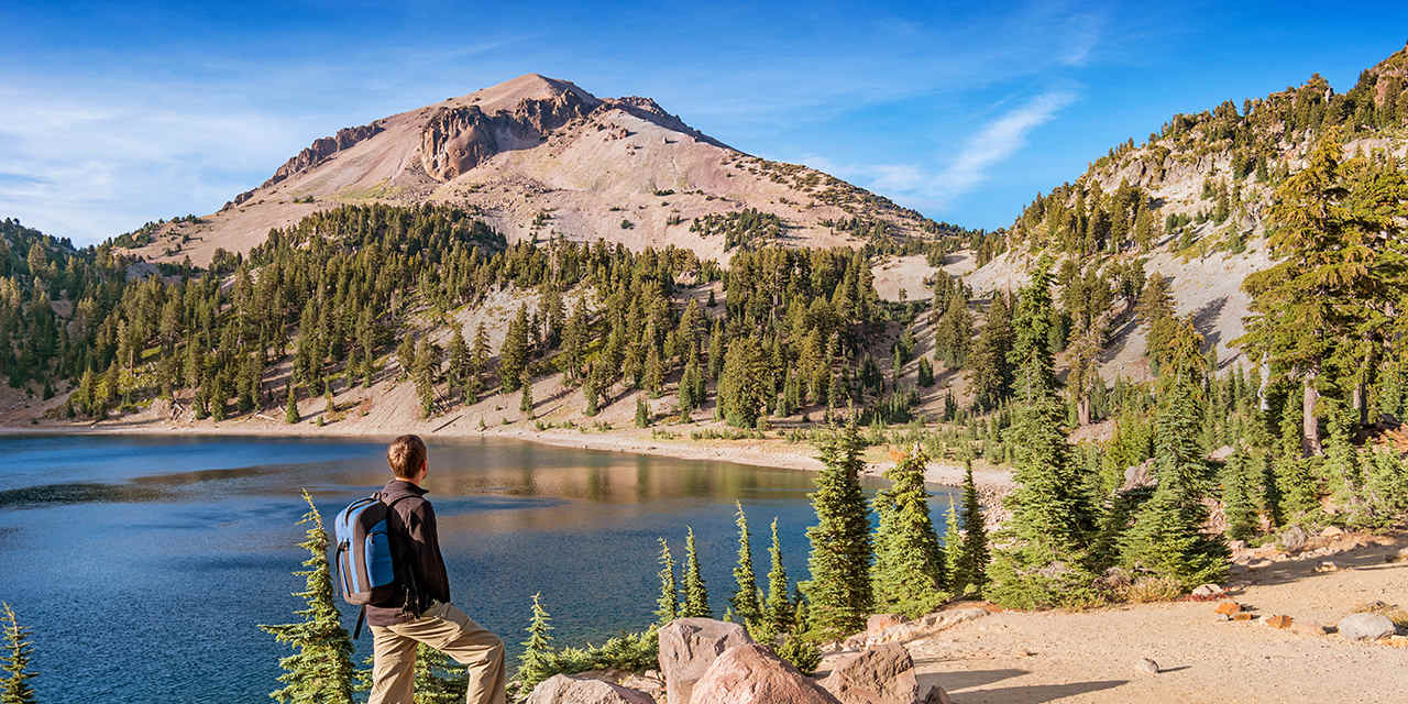
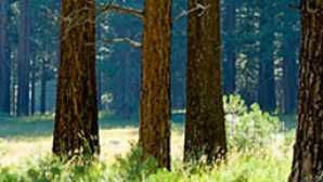
Spotlight: Lassen Volcanic National Park
Boiling springs, sparkling lakes
Steaming sulphur vents, splattering mud pots, boiling springs—these lively features show that the earth is not quiet in this fascinating park in...
Kodiak Greenwood
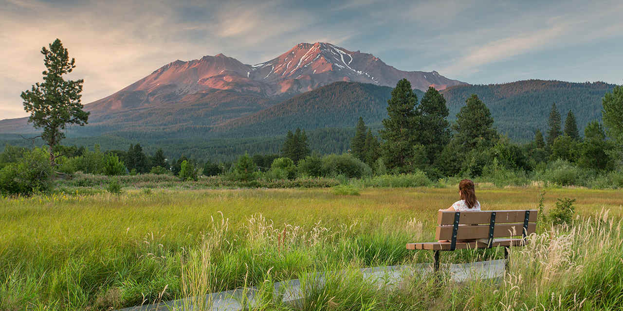
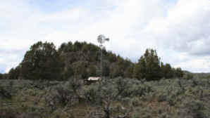
Mount Shasta
Mount Shasta
Experience wildflower meadows, rear-round snowfields, and a New-Age-y vibe
Soaring to 14,179 feet/4,322 meters high, this magnificent volcano scrapes the turquoise-blue sky, north of Redding, a totem from almost anywhere in the northern part of the state. And while some mountains climb gradually, this one rises from surrounding flatlands in such perfect, cone-shaped, snow-capped majesty that it seems almost unreal—the perfect projection of a child’s fantasy of what a mountain should be.
"Yet this is no childish vision—it’s a very real, very big volcano (last erupted in 1786) that is on the bucket list of serious mountaineers."
(Famed naturalist John Muir wrote that his “blood turned to wine” when he first caught sight of the Fuji-esque peak.) Summiting the mountain is for the hardiest of climbers; ask about guide services at The Fifth Season outdoor store in the town of Mt. Shasta, a New Age-y enclave on the mountain’s west side. (Get the town’s vibe at The Crystal Room , a prism-filled visual feast.)
Fortunately, you don’t have to bag the peak to enjoy this alpine paradise. Easy paths loop through wildflower-filled meadows and into cool forests. One of the prettiest trails, a mellow two-mile path along the McCloud River on the mountains south, leads to a trio of waterfalls—all beautiful, though Middle Falls is the real head-turner. There’s camping, caverns, and world-class fly-fishing too. Most winters, there’s skiing too, at low-key and local Mt. Shasta Ski Park, on the mountain’s western slope.

Kodiak Greenwood
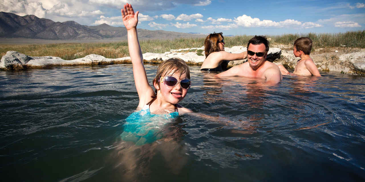
Natural Hot Springs in Mammoth
Natural Hot Springs in Mammoth
Where to soak in nature’s natural spas
With its regal mountain majesty and alpine hush, it’s hard to imagine that Mammoth Lakes is situated on the edge of an ancient volcanic caldera. Here, some 760,000 years ago, a massive volcano exploded, leaving behind the relatively flat basin now cradling Mammoth Lakes. A wonderful byproduct of this fiery past is the region’s network of natural hot springs. Many of these bubbling hot tubs, some developed for safe dipping, are concentrated between Bridgeport and Mammoth Lakes. Stop by the Mammoth Lakes Welcome Center (just west of U.S. 395 at 2510 Main St.) for locations and directions. Also check on access; routes may be closed in winter.
Here are three natural hot springs in the region, all safe for soaking.
Benton Hot Springs: In the almost-ghost-town of Benton, relax under shady cottonwoods in one of nine tubs filled with ultra-pure spring water. Each tub has hot and cold taps so you can easily control the water temperature. The springs are on the grounds of the Old House and Inn at Benton Springs, where you can book a stay in a late-1800s ranch house or a 1940s-era lodge room. Springs are located on State Route 120 about an hour's drive northeast of Mammoth Lakes; reservations suggested.
Travertine Hot Springs: Get sweeping views of the east side of the Sierra Nevada while you soak in this natural hot spring. You can pitch a tent nearby, though not adjacent to the springs. Travertine Hot Springs is easily accessed off U.S. 395 just south of Bridgeport (about an hour's drive north of Mammoth Lakes).
Keough Hot Springs: First opened as a medicinal and health retreat in 1919 (the water is said to contain 27 different minerals), these springs are still a great place to soak and relax. There's camping on site, and lodging options include several tricked-up cabin tents, some with queen-size beds and down comforters. From Mammoth Lakes, drive south about 1 hour on U.S. 395 to Keogh Hot Springs Road. Closed Tuesdays.


Kodiak Greenwood
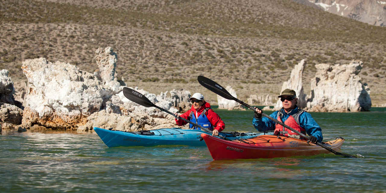
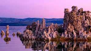
Mono Lake Tufa State Natural Reserve
Mono Lake Tufa State Natural Reserve
Visit bizarre formations, cinder cones, and a super-salty lake
There are few places in California—and maybe on the planet—that can make you think you might just be on Mars. This is one of them. At this high-desert preserve, on the eastern side of the towering Sierra, ghostlike tufa towers trim the edges of a one-million-year-old lake, the salty remnant of an ancient inland sea. Over a million sea birds feed on the surface and swirl overhead—and incredible show of life in this seemingly desolate setting.
Get yourself oriented with a visit to the excellent interpretive center, just off U.S. 395 north of Lee Vining and Tioga Pass (the only route into Yosemite from this side of the mountains). Inside, exhibits shed light on the natural and human history of the Mono Basin, including major environmental challenges caused by water diversions that almost killed the lake. (Huge efforts by the local Mono Lake Committee, with a gift-filled shop in Lee Vining, have successfully saved it.) Wraparound decks offer expansive views of the dramatic setting—Sierra peaks to the west, chaparral-dotted desert to the east, and views of the lake and its tiny Wizard Island, an important nesting site for Western gulls and other sea birds. Bird walks are offered at 8 a.m. Fridays and Sundays, mid-May through Labor Day. The Visitor Center is closed Dec-Mar.
Trails lace the area; you can explore rehabilitated Lee Vining Creek riparian habitat and the region’s cinder cones, blanketed with with obsidian and pumice, or walk in the South Tufa Area, with close-up views of the lake-trimming calcium-carbonate spires and knobs formed by the interaction of freshwater springs flowing into the ultra-alkaline lake water that’s 2½ times as salty as the ocean. Naturalists lead free tufa walks at the South Tufa Area three times daily from late June through Labor Day. Guided paddles are also offered through Caldera Kayaks.

Jeff Mosers/ Flickr
Grover Hot Springs State Park
Grover Hot Springs State Park
Soak in naturally heated mineral pools
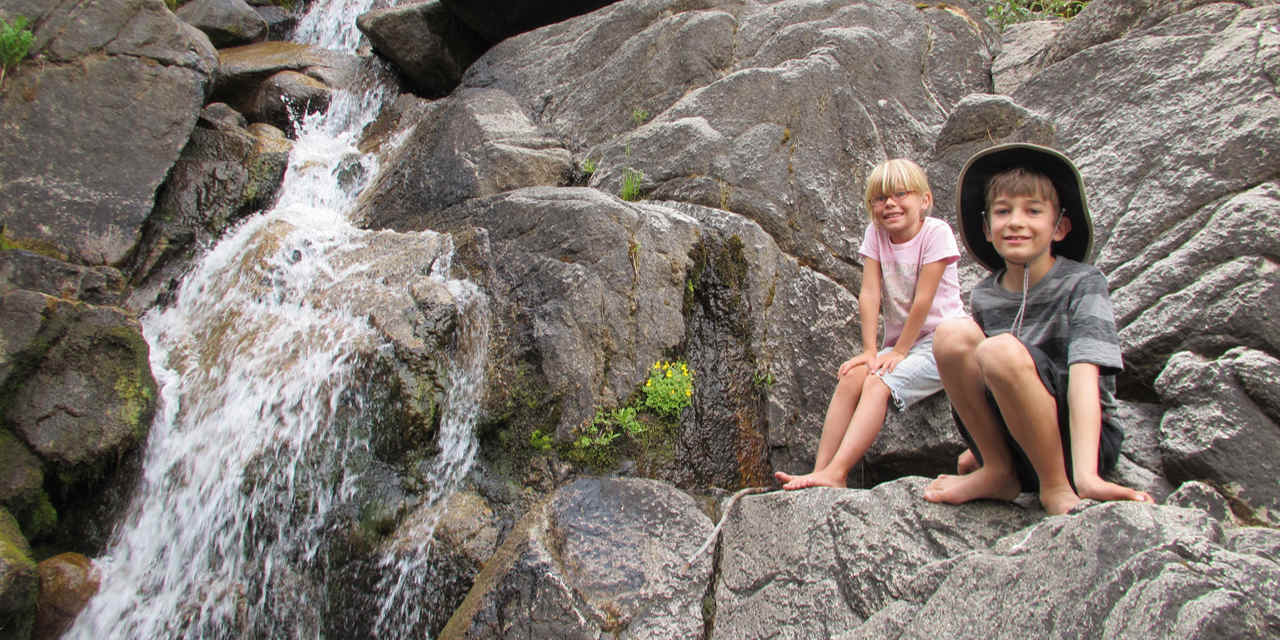
Nestled in a notch of the High Sierra about an hour’s drive southeast of Lake Tahoe, mineral springs bubble up from the earth, a testament to the geologic and geothermal forces that have shaped this landscape. This state park, just west of the quiet mountain town of Markleeville, may or may not have been discovered in 1844 by John C. Fremont, the explorer credited with first sighting Lake Tahoe. Historians haven’t settled that debate. But no one disagrees that since the 1850s, people have flocked to “take the cure” in these restorative waters.
The park’s pools are fed from six different springs containing low amounts of sulfur. That means you won’t notice the strong “rotten-egg” smell of many hot spring pools. The water emerges from underground at a scalding 148°F/64°C, but it’s cooled down before it’s piped into the park’s two concrete pools—one for soaking at a safe 103°F/39°C, the other a pleasant temperature for swimming and splashing.
The pools are open most of the year (hours may vary during the off-season/winter period, September through May, so call ahead; 530/694-2249). The state park also has a 76-site campground and hiking trails, some easy scrambles for the kids (don’t miss the walk to the waterfall along Hot Springs Creek), as well as longer treks into surrounding alpine regions.


Courtesy of Bureau of Land Management
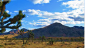
Amboy Crater
Amboy Crater
Hike into a 6,000-year-old volcanic remnant
Hike into a 6,000-year-old volcanic remnant
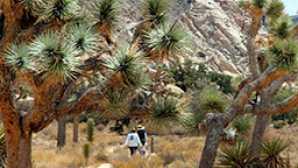
Designated a National Natural Landmark in 1973 and located just off historic Route 66, Amboy Crater is an example of geology creating geometry—it’s an almost perfectly symmetrical volcanic cinder cone. This 250-foot/76-meter bump in the Mojave National Preserve landscape provides panoramic views of some astounding features, including a 26-mile-/42-kilometer-long lava flow, Bristol Dry Lake, and the Marble Mountains.
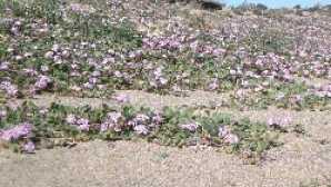
A maintained trail climbs gently around the cone’s western half, leading into the breach where basaltic lava poured out over a vast area, creating lava lakes, collapsed lava tubes and sinks, and spatter cones. Once you’re in the cone’s center, hike straight into the caldera, or climb one of the steep trails to the rim. The view from the 1,508-foot/460-meter-wide rim will awe you as you take in the vastness of the Mojave Desert, where faraway cars on desert highways look like miniature toys against this epic landscape.
As with other Mojave locations, you won’t want to hike here from late spring into early fall when temperatures routinely top 100°F/37°C. So time your visit in winter or early spring not just for more comfortable temperatures, but also for the desert wildflower bloom, which can begin as early as February, depending on winter rains.

Cyril Fluck/Flickr
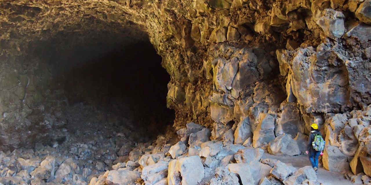
Lava Beds National Monument
Lava Beds National Monument
Descend into eerie and historic lava tube caves
A surreal landscape sculpted by molten earth, Lava Beds National Monument contains volcanic tablelands punctuated by cinder cones, pit craters, and spatter cones, plus more than 700 caves. These strange features were formed when the outer edges of flowing lava began to cool, forming tubes. When molten lava stopped flowing, hardened tubes were left behind.
Though the scene can seem barren and desolate, look closer. The scrabbly earth and dark rocks of the rugged lava flows are dotted with sagebrush, mountain mahogany, and Western junipers, creating habitat for mule deer, pronghorn antelope, rabbits, and bird species, including bald eagles. Bring binoculars and see what you can spy, especially early mornings and evenings.
You’ll also want to bring a good headlamp or flashlight—and a jacket—for exploring the lava tubes. In summer, this part of California can get pretty toasty, with daytime temperatures of 100°F/37°C or more. But inside the lava tubes, it’s remarkably cool; you may even find year-round ice.
You can explore the tubes on your own (no spelunking experience is needed, and kids flip out at the thrill of entering these mysterious formations). And although you won’t cover much ground, the trek can be a workout as you duck, twist, and even crawl through natural tight squeezes. It’s easy to see how these caves were used as hideouts during the Modoc War in 1872-73, the only fight against Native Americans in California, in which Native Americans fought U.S. Army troops in defence of their homelands.
Some two dozen tubes are open for exploring along Cave Loop Road, near the visitor centre. Most of the park’s caves are rated for difficulty, and first-time explorers should start with the Hopkins Chocolate Cave (1,405 feet/428 meters) or Blue Grotto Cave (1,541 feet/469 meters). For the ultimate challenge, consider entering the remarkable Catacombs Cave, one of the park’s longest and most complex, with a total length of 6,903 feet/2,104 meters.


Photo by The Greater Southwestern Exploration Company/Flickr
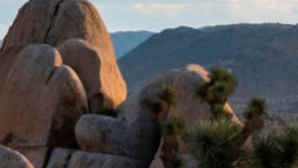
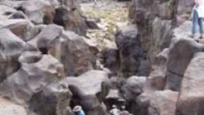
Fossil Falls
Fossil Falls
Rushing river, sculpted black lava
The truth is that the name Fossil Falls is a bit of a misnomer. After all, there are neither fossils nor a waterfall here. But a walk through these polished lava formations about 36 miles/58 kilometers northwest of the desert city of Ridgecrest is a highlight of any drive along Highway 395.
This remarkable site was formed by the interaction of rushing water from the Owens River (which in wetter prehistoric times flowed at a much higher rate) with lava that poured from nearby volcanoes as recently as 20,000 years ago. The result is this surreal, convoluted chasm of shiny, sculpted black lava. A short trail leads to the falls, which you can observe from above or, for a closer look, follow a trail to carefully descend the falls (hold onto children’s hands as footing can be tricky).
Insider's Tip: Night skies in this remote high desert locale are also spectacular; check out the nightly celestial show from the Fossil Falls campground with 11 sites (potable water and restrooms on site), plus picnic tables and fire rings.
Greater Southwestern Exploration Company/Flickr
Fossil Falls
Fossil Falls
Rushing river, sculpted black lava
The truth is that the name Fossil Falls is a bit of a misnomer. After all, there are neither fossils nor a waterfall here. But a walk through these polished lava formations about 36 miles/58 kilometers northwest of the desert city of Ridgecrest is a highlight of any drive along Highway 395.
This remarkable site was formed by the interaction of rushing water from the Owens River (which in wetter prehistoric times flowed at a much higher rate) with lava that poured from nearby volcanoes as recently as 20,000 years ago. The result is this surreal, convoluted chasm of shiny, sculpted black lava. A short trail leads to the falls, which you can observe from above or, for a closer look, follow a trail to carefully descend the falls (hold onto children’s hands as footing can be tricky).
Insider's Tip: Night skies in this remote high desert locale are also spectacular; check out the nightly celestial show from the Fossil Falls campground with 11 sites (potable water and restrooms on site), plus picnic tables and fire rings.

CALIFORNIA
Choosing your dream wedding location—one that reflects who you are as individuals, and as a couple—is a key part to creating your perfect celebration. California has an...
California: Luxury
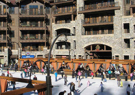
Kicking back after you kick off your boots is a snow-country tradition, and there’s plenty of post-slopes fun at California’s top alpine resorts. Have a beer or warm up...
Discover the Central Coast
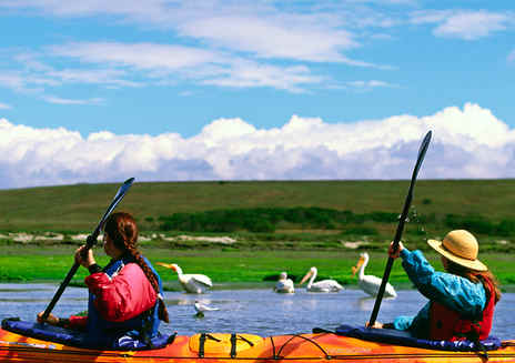
This expansive estuary explodes with life, and even better, it’s really easy to see it. Kids love clambering aboard a 27-foot open-air pontoon boat with Elkhorn Slough...